Map of Kuala Lumpur
Below an interactive Google map of the city of Kuala Lumpur. You can simply scroll through the map with your mouse. Use the markers on the left to zoom in or out of the city map.
On this page:
- Map Kuala Lumpur Rail System
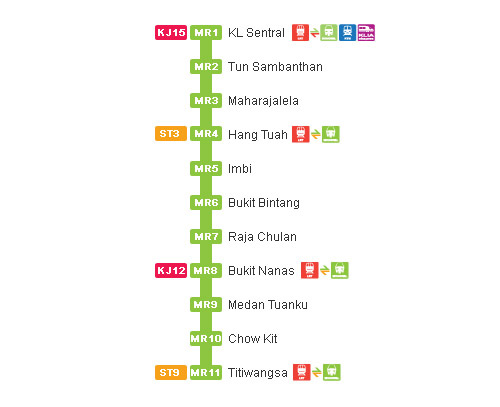
- Map Kuala Lumpur Monorail
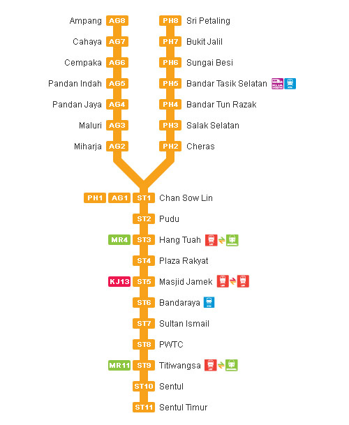
- Map RapidKL Ampang line
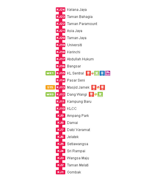
- Map RapidKL Kelana Jaya line
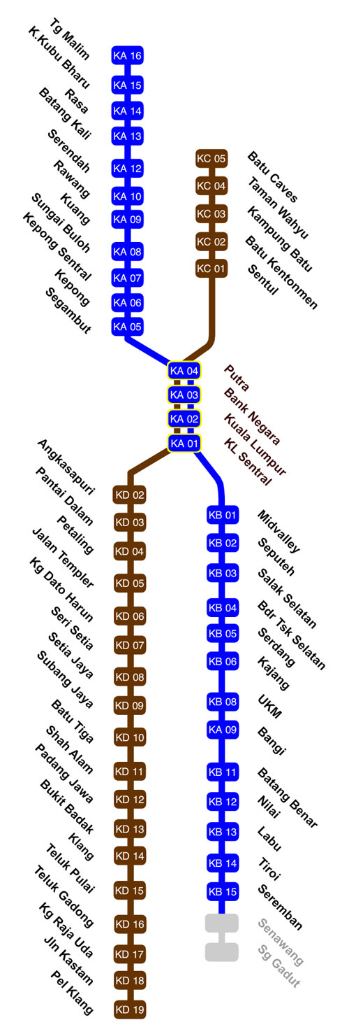
- Map KTMB Komuter
Map Klang Valley Integrated Rail System
The mass transit system contains the following lines: Klang Valley Integrated Rail System (which consists of the LRT lines Ampang & Kelana Jaya, the KTM Komuter lines and KL Monorail). Download a .pdf that you can print easily here!
Map stations Monorail Kuala Lumpur
Map stations Ampang line Kuala Lumpur
Map stations Kelana Jaya line Kuala Lumpur
Map stations KTMB Komuter line Kuala Lumpur
